Th
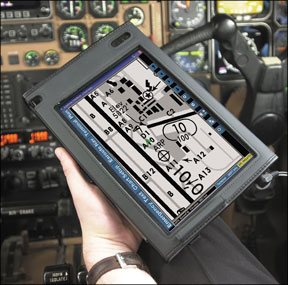
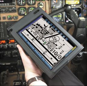
despite the fact that both Jeppesen and NACO e-charts can be printed by the user. Were all about cutting edge products and services, but were not electronic evangelists, either. If buyers predominantly prefer paper, its worth comparing the choices.
Legalities
To be legal for IFR, youre supposed to have current charts, under the catch-all “all available information” of FAR 91.103. But its the grayest of gray areas. The dirty little secret is that many pilots ignore this requirement in varying degrees and while we don’t condone this, we cant blame them. The risk of an accident, incident or violation due to expired charts is minimal, but still possible. Sticklers will insist on having the freshest possible nav data and we don’t blame them, either.
But having current charts might not even guarantee that you have the most up-to-date information. Case in point is the Comair crash in Lexington, Kentucky, on August 27, 2006. The crew had the latest IFR charts, but failed to note a NOTAM that pointed out a new taxiway leading to Runway 22, to which they were cleared.
They made a wrong turn onto a shorter runway that went unnoticed by the lone air traffic controller who cleared them for takeoff. Forty-nine of the 50 people aboard died in the crash, when the jet rolled off the too-short runway and crashed in a field.
In this article, we’ll examine how the various charting providers revise the data. Another important consideration is readability of the chart typography. Jeppesen continues to be the leader in this respect, but the FAAs National Aeronautical Charting Office (NACO) has improved its products and closed the gap.
For many pilots, the top consideration is how easy the charts are to use in the cockpit. Specifically, this speaks to the size of the charts, binders, clips and, for e-charts, the hardware to view the charts.
Jeppesen
There’s no disputing that Elroy B. Jeppesen invented aeronautical charting as we know it; the government got into the act later. In 1934, Jeppesen began publishing the first airway manuals that provided pilots with valuable navigation information, airport elevations, heights of obstructions and runway lengths. At the time, the manual sold for $10 (about $150 in 2007 dollars).

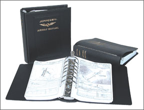
Today, Jeppesen is a subsidiary of Boeing and offers a wider selection of IFR chart products in paper and electronic format and at various price points than any other source. The companys basic Airway Manual service consists of a new content package with the most current paper approach plates and enroute charts that are easily organized in seven-ring binders. Jeppesen sells this service for the entire
U.S. or geographic areas big or small, including the West, East, Northeast, Southeast and Northwest.
IFR approach chart revisions are sent every 14 days, along with updated enroute charts when needed and, importantly, chart NOTAMs and/or critical NOTAMs already incorporated on the charts themselves. Incorporation of these NOTAMs on FAA NACO charts is slower and youre expected to buy a separate and expensive publication to keep up on these changes.
While it might be the most current paper charting system, Jeppesens 14-day revisions require tedious insertion of new approach charts into the binders. The larger your coverage area, the more time consuming and dreaded revisions become. Responding to customer demand for an easier way, Jeppesen introduced Q-Service and Express Service subscriptions. For a price premium, Q-Service, revision packets are sent every two weeks but are filed by sections, rather than by individual pages. Every eight weeks, you get an entire fresh set of charts and the cycle begins anew. This yields a lot of wasted paper, but saves the customer considerable time. Q-Service subscriptions come in a variety of options full U.S., West, East and other geographic areas but the price of convenience isn’t cheap. For example, a full-U.S. Q-Service subscription costs $1517 annually.
Express Service is similar to Q-Service, but it divides the country into individual state coverage. Under this plan, new contents are sent every 56 days or, optionally, every 28 days, but there are no two-week revisions, as with Q-Service.
Jeppesen also sells “high-performance” coverage for corporate pilots, with only approach charts for airports with runway lengths of at least 4000 or 6000 feet. This reduces the paper volume and makes the two-week revisions more manageable.
What sets Jeppesen apart from NACO is the extras that come with all of its subscriptions. This includes an extensive legend, as we’ll as ATC preferential routes and a tabular listing of minor changes not on the plates themselves. Additionally, the plan section on Jeppesen plates include use of colors to identify mountain ranges and bodies of water.
In our opinion, Jeppesens paper and typography make its charts more readable than those from the FAA. The paper, while thin, is bright white, the printing is clearer than NACO charts and chart elements are larger and easier to read, especially at night.
In 1998, Jeppesen added the briefing strip, with frequencies, final approach course and altitudes prominently displayed across the top. The FAA followed Jeppesens lead in 2001, although the FAAs so-called Volpe briefing strip design isn’t quite as easy to use, nor is the print as large as that on the Jeppesen charts. While we like Jeppesens typography, the FAAs version of enroute charts is better, in our opinion. This is because Jeppesen enroutes are printed on thin paper that, while easy to fold, are susceptible to tearing. The FAAs enroute charts are printed on sturdy paper that can take a beating and can even get wet. Additionally, Jeppesens use of color on its enroute charts is a bit overdone, which can make it hard to find what youre looking for. The FAAs less-is-more approach to color on these charts is right on the mark, in our view.
Government Issue
The FAA sells its charts in both four-hole loose-leaf and perfect bound versions. However, most pilots prefer the bound charts, since the loose-leaf version requires special four-ring binders that thread through the top of the pages. While the loose FAA charts allow you to remove and clip a plate to the yoke, this task is often not worth the trouble. The Jeppesen charts, with their holes on the side, are easier to use in this respect.
Like Jeppesen, the FAA offers bite-size coverage, with enroute charts covering regions and approach plate booklets covering a state or region. Because of the growing number of approaches, coverage for some large states are split into several booklets. In fact, if you want coverage for all of Texas, you’ll be carrying three booklets; for California, its two. Nonetheless, the bound books are easy to handle and theyre simple to mark with a rubber band.
Revisions to NACO charts are a snap. The government mails you new charts and booklets every 56 days and you toss the old stuff. A 28-day Change Notice informs pilots of in-between changes these are automatically sent to NACO chart subscribers or you can buy them piecemeal.
There’s no doubt that the government charts have improved since the FAA took over the charting task from the National Oceanic and Atmospheric Administration in late 2000. Although the paper no longer has a gray tinge and the printing is crisper, the chart design itself still uses smaller type thats harder to read than the Jeppesen version.
For airport diagrams, the Jeppesen charts beat out those from NACO, in our view. Jepps runway and taxiway diagrams are both more detailed and current, which yields better situational awareness for the taxiing pilot who doesnt wish to become the next runway incursion statistic.
Many pilots opt for NACO charts because they assume theyre cheaper than Jeppesens. For the most part, this is correct, but as coverage areas vary between the two competing products, so do costs. Full U.S. coverage from Jeppesen costs $1078, while the same coverage from the FAA costs $660.45 ($352.80 for approach charts and $307.65 for enroute charts). However, depending on the geographic coverage you need, yearly subscription prices between Jeppesen and NACO could be comparable, especially for small coverage areas.
Air Charts
Since government data cant be copyrighted, anyone can repackage and sell it at [
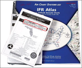
will, which is exactly what Air Charts has been doing since 1962. The company turns the FAAs normally folded low-altitude enroute charts into 11-inch-square bound atlases. It also provides government-printed loose-leaf or bound approach plate booklets, although its update revision service doesnt have you toss the booklets every 56 days. Instead, the updating method is essentially a NOTAMs-monitoring service that mails out chart changes on a four- and eight-week cycle.
Heres how it works: Air Charts cycle runs from May to May of each year. When you sign up, you get new contents the bound enroute atlases and a fresh set of NACO approach plates. Air Charts includes stickers to cover up the expiration date on the approach plate cover with a notice to check the latest revision sheet provided by Air Charts.
Revisions are sent on paper every eight weeks, with a postcard listing minor changes on a four-week rotation. The NOTAMs are given in text form, by state, so its easy to find revisions that apply to your route. However, decoding these NOTAMs is sometimes challenging. The enroute atlases have a pouch in the back where the sheet can be stored. These sheets are replaced throughout the annual cycle by new ones containing cumulative changes.
The idea is that you pencil in any changes right on the chart or plate as needed, so you don’t need to swap out old plates with new ones or discard lots of paper. This system is easy and requires little effort on the users part. If the updater indicates that a chart has changed significantly or a new one has been issued, Air Charts will send a printed version to you upon request for $1 per airport, or you can download it over the companys subscriber-only section on its Web site.
When it comes to IFR chart pricing, its hard to beat Air Charts. The IFR kit includes full U.S. enroute coverage, approach plates and updates for $279 a year. You can also mix and match to buy only the specific approach plate coverage needed, which reduces overall costs, making Air Charts efficient and a good value for the price.
However, nothings perfect the NOTAM updaters type size is small, making it hard to read and the binding breaks on the bound IFR charts, which is a nuisance, in our estimation. On the other hand, the charts are always present and accounted for.
Electronic/Online
Were not focusing here on e-charts, but we need to mention the options. As previously mentioned, Air Charts subscribers can download approach plates via a subscriber-only section on its Web site. But anyone with Internet access can download NACO digital charts (e-charts) for free from the FAA site. The only caveat is that you must download each chart separately, but its free.
If youre an AOPA member, your $39 annual membership fee will allow you to log onto the member-only portion of its Web site where you can download digitized NACO charts in batches. The batch download option is straightforward: Check the boxes next to the charts that you want, click download, unzip the file and then open the PDF files in Adobe Reader, where you can view and print them. This is by far the best deal for quickie trips and one offs, but you need to print any approach charts that you even think you might need before you take off. While you could use this as a primary source for approach charts, we don’t think its practical.
For those contemplating the switch solely to e-charts, the leading option is Jeppesens JeppView, which is CD-ROM-based. But Control Visions Pocket Plates, which digitizes and manages NACO charts, is a contender.
JeppView features all of Jeppesens approach plates, with the same coverage options as its paper counterparts. However, the enroute charts that come with JeppView are still on paper. Full U.S. coverage is $738 a year, but regional coverage starts at only $248 annually (this is for the West). Instant electronic trip kits are also available should you need to do a trip thats outside your subscribed coverage area.Just call Jeppesen and, for a fee, theyll issue a passcode that will allow you access to the data on the CD-ROM. JeppView is updated every 14 days, and they can be received via CD or Internet.
According to Jeppesen, you don’t have to use a tablet PC to display e-charts in the cockpit. “Many of our customers have made the transition to electronic charts by using only their home PC. Our software allows you to create smaller sub coverages and print out only the charts you use most often,” according to the company. This means you carry less paper and for each update cycle, you only print the charts that update your coverage.
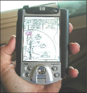
Anyone serious about switching to e-charts would be we’ll advised to purchase a tablet PC, starting at about $1000 nowadays. (Were planning a review of these devices.) Alternatively, a Windows-based palmtop computer with JeppView installed might suffice, but its hardly ideal, in our opinion. These devices have small screens, so you’ll have to view only sections of the chart at a time instead of the entire thing at once glance.
Another option gaining ground is the so-called electronic paper introduced by ARINC in its eFlybook product. For a complete review of this, see the November 2006
Aviation Consumer. Although NACO doesnt have the equivalent of JeppView, the viewable PDFs in the eFlyBook come close. But they arent printable.For that, there’s Sportys Chart Viewer and Control Visions Pocket Plates. Sportys Chart Viewer sells for $9.95 and offers a CD-ROM with full U.S. NACO approach chart coverage. Pocket Plates runs on PDAs, tablets and desktops and allows viewing in the cockpit or printing out of select charts. Pricing varies by bundle, but the basic software is $95. we’ll examine these in detail in a future article.
Conclusion
Jeppesen believes that pilots will someday no longer want to carry paper charts, meaning a larger percentage of its future business will be electronic. In fact, the company estimates that the current 20 percent who have switched to e-charts will grow to 50 percent by the end of 2008.
This goal might be achievable, especially since Jeppesens online poll shows that 60 percent of current e-chart agnostics wont switch because of cost. According to its pricing comparisons, JeppView costs 30 to 50 percent less than its paper chart subscriptions. However, this puts JeppViews price closely in line with the NACO paper chart subscription costs.
Will people ditch government paper charts for Jeppesen e-charts on a cost basis? Maybe yes, maybe no. Its not a simple black-and-white issue, as user chart preference comes into play, as does comfort level with technology, among other factors. Further, the available technology will also influence the move from paper to vapor.
While JeppView is ready for prime time and could be poised for exponential growth, paper still reigns at least for now. Control Visions Pocket Plates is an option, but thus far a bit player. In the ideal world, we would be using perfect-bound paper Jeppesen plates with the simplified revision service offered by Air Charts. But alas, thats not going to happen.
The bottom line is that if cost is no factor and you can tolerate time-consuming revisions, our top recommendation is the Jeppesen standard or Express Service paper subscription. you’ll always have the most accurate, current and readable charts available on the market.
But if you want painless revisions and low cost, then Air Charts clearly offers the best bang for the buck. The companys spiral-bound IFR atlases are easy to use in the cockpit and the NACO charts will get you on the ground safely and thats what really counts. Were all for going electronic with charts and plates, but the market hasnt yet voted with its dollars, so we understand the reluctance to dump paper charts. We havent done that, either, and probably wont for some time to come.
Contacts…
Air Charts System, 800-338-7221
http://www.airchart.com/
Control Vision, 800-292-1160
http://www.anywheremap.com/
Jeppesen, 800-621-5377
http://www.jeppesen.com/
Sportys Pilot Shop, 800-776-7897
http://www.sportys.com/

