by Jane Garvey
If youre the kick-the-tires-light-the-fires type, flight planning may consist of squinting upward while opening the hangar and putting a fingertip on a map occasionally.
For the rest of us, there’s an array of cyber-helpers from Spartan to plush, with price tags to match. Once again, weve reviewed the surprisingly persistent Big Three, with a nod toward the crowded but less visible lower tier.
Once upon a time, Macintosh users had at least one option among the large commercial products. But no more. There are some commercial flight planners for Macs out there, FlitePrep likely being the best known. Tiptoe through Google and you’ll undoubtedly unearth more, but the companies holding the majority of the market are PC-only.
The first task when shopping for a flight planner is to determine how much help you want. Are you interested in just an automated E6B to fetch winds aloft and plug them into your user-defined route? Something that will print out your route on a map? A decent nav log form to carry to the cockpit? If any or all of this meets your needs, there’s a free or low-cost program that will do. If you pine for a planner that will do everything except the pre-flight, get out the wallet.
Free
Free is good, so lets start there. If youve never actually used the DUAT flight planner, try it, directly by dial-up or internet connection or online through AOPA for members.
Obviously, DUATs automatic planning function wont hold your hand to the extent the multi-hundred dollar programs will and we doubt seriously whether anything approaching the same level of effort has gone into the routing algorithm.
Neither will it plot pretty pictures and weather depictions along your route. Nevertheless, DUATs utility improved substantially when they added weather graphics some time back so VFR only and occasional IFR folks may we’ll be satisfied with this option.
There are other free flight planners touted online, but were a little picky about downloading .exes from obscure sources, particularly those overly fond of exclamation points, so we’ll leave their perusal to our more adventurous subscribers.
There are multiple sources of navigational data out there, commercial and governmental, and these have been parlayed one way or another into something of a cottage industry for home grown flight planning programs.
We sidestepped most of those offerings and selected Adams Flight Planning Software for Windows from the remainder, essentially by the dartboard method.
Using FAA data, the programs author, an instrument-rated private pilot and longtime programmer, created a simple program which does both more and less than DUAT, with a more attractive interface. Adams Flight Planning is vastly smaller and less versatile than the big programs but it costs less money and is less demanding of computer resources.
Route waypoints and winds aloft always have to be entered manually, while DUAT will do the latter for you automatically to one extent or another. On the other hand, DUATs flight plan printout is positively primitive and has no ability to show and print a route graphically, which Adams Flight Planning Software does.
The high-end 32-bit programs undoubtedly consider it quaint, but this program has a DOS display option, which could be alluring to a pilot who has demoted an old low-end machine to the hangar where DUAT isn’t likely to be available anyway. If the features are sufficient for your needs, the price is right at $39.95 for the program and initial data. A years update subscription is pricey at $125, but one shot downloads are only $25.
Most of these lower tier programs have demos, so you can check them out for yourself. In our view, if you don’t want an automatic planning function or at least a map with rubberband routing, there’s little reason to pay for anything. That said, you may we’ll find something thats just the low cost ticket for your needs.
Mainstream
Each of The Big Three has made great strides in features and functionality since our last review and each offer a dizzying array of versions, la carte components and subscription packages, complete with charts to help you navigate the options. Each also supports a moving map function and GPS or FMS upload of routes and either have or say they are working on some sort of portable data device capability.
In the interest of space, we have considered here only the individual VFR and IFR iterations. Even within those, we havent described everything. Consequently, we recommend strongly that you spend some quality time on your own with the demos or in the websites before you commit.
The online giant, Aeroplanners Navigational and Planning Services, recently bought Destination Direct. The resulting cross-pollination of two popular but distinct flight planning capabilities enables both online and offline flight planning. An Aeroplanner subscription is an additional fee, but depending on your existing DD subscription, the differential currently is as little as $5. That subscription allows you to download and utilize inside the program a cartographers Nirvana of maps and charts.
Knowing pilots as we do, we started with each program just punching buttons, exploring drop down lists and otherwise seeing how easy the thing was to use out of the box. Again, Destination Direct was friendly and intuitive.
In the brave new world of homeland security, temporary flight restrictions have become a worry. Destination Direct has the latest and greatest TFRs available for download directly from their website and can display same graphically with your route. Its sobering to do just that, particularly in the east. The Aeroplanner subscription tie-in has plugged the not inconsiderable hole of sports TFRs with a map generated by FAA coordinates. Click on the area of interest and the full NOTAM is displayed below.
The map label declutter function needs some help and you cant grab the solid course line with the mouse and pull it out of the way to confirm that youre on an airway, as you can in Flitesoft and FliteStar.
On the other hand, your route can be overlaid on downloaded maps with weather depiction along the route, including the ability to rubberband over or around areas of concern. Historically, DD always contained the most options for flight planning defaults, including avoidance of water. It remains the only one of the three which includes this option in automatic planning.
Destination Direct tends to be less consistent in its results in the automatic planning function, but when it was good, it was very good and routinely does the best job of picking fuel stops hands off. In almost all test routes, DD picked the shortest route, although it sometimes needs a little help when difficult airspace has to be avoided. On the other hand, Destination Direct seemed to be better at recommending a correct SID or STAR than were the others.
Since our last review, DD has acquired the same profile view offered by Flitesoft and FliteStar. Just over 30 aircraft data profiles are available for download and these have a rather peculiar distribution, so don’t buy Destination Direct thinking it will keep you from having to reread the POH to set up for your aircraft.
For VFR personal use, DD costs $149. Professional (including the FBO and related databases) is $199. The IFR version of each is $229 and $295, respectively. If you need more than one pilot profile, you’ll have to go with the appropriate Pro version. There’s no annual VFR subscription. One update in a year will cost you $55; three are $120. Serious IFR pilots may need more than the one-shot update of $75 for personal and $80 professional, of course. The personal IFR version can be updated every other month for $215 annually. The full-bore nav plus FBO data every 28 days will cost a cool $450 per year.
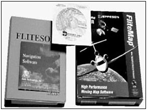
Flitesoft
RMS Technologys venerable Flitesoft also has made considerable strides since our last review, including vector map capability for all of North America. This means you can select an underlying display very much like a sectional chart which is scalable to just about any resolution youd need. At the outset, we’ll note that if not having access to the Jeppesen navigational database is a deal-breaker for you, skip Flitesoft. It uses DAFIF data only. (See sidebar at end of story.)
Always a solid, user friendly program which was stable and not absurdly demanding of resources, Flitesoft now boasts impressive new whistles and bells. In addition to current navigation vector data, RMS maintains for online download scans of current sectionals as we’ll as low and high airway charts (48 states). The scanned charts are displayed with your planned route overlaid but they cant be printed.
Like Destination Direct, Flitesoft maintains current TFR information for download and displays them graphically but doesnt currently have the capability to display the stadium-avoidance zones. It still doesnt do automatic leg computation, as do the other two, but Flitesoft will let you eyeball the proposed stop point or use the flight log output and then select Bargain Fuel Locator for that area. If you rubberband to one of those results, it inserts a stop, a utility we like. Unique to Flitesoft is the ability to display temperature and dewpoint spreads right on the route map as we’ll as the current trend. Also on the weather front is a feature called Radar in Motion, which enables you to play the radar returns for the last six hours.
Flight Check looks over your shoulder on altitude selections, checking against course, terrain and MEAs, as appropriate. Flitesoft also renders a graphic display of terrain clearance in the profile view for the route, if you wish. Flitesoft did the best of the three in planning useable and accurate routes through vertical terrain. On our sample flight from Colorado Springs to Las Vegas, for example, Flitesoft was the only one that picked a legitimate way through the rocks within the service ceiling of our Cyber172. On the other hand, it wont let you automate avoidance of over water routes, as does Destination Direct.
From years of soliciting and collecting data from customers, Flitesoft now boasts over 200 aircraft data modules, far more than either of the others, which may spare you puzzling out all that moment-arm business you dumped from RAM after the last exam. Just make sure you check the result before relying on them to cut that W&B close.
The RMS product includes 30 minutes of how-to video imbedded in the program. For another 20 bucks, theyll send you a CD with an astonishing 4 1/2 hours of video demonstrating every single gadget and gizmo. On the other hand, Flitesoft is alone in this group as having no demo available, no post-use return policy and no toll-free customer support. Youre invited to read the manual, check out a friends copy or get out a Ouija board to see if Flitesoft is what you want, but once you open the envelope or 30 days passes, its yours.
In fairness, RMS doesnt copy protect its disks, so youre able to load the program on the desktop, laptop, at work or whatever without a problem. Nevertheless, we find their return and support policies troubling.
Flitesofts minimum computer requirements are the least demanding of The Big Three. A Pentium-50, 32 MB RAM recommended, 50 MB minimum free space on the drive and a VGA or better monitor. Flitesoft will run on any Windows version from W95 up, which may be a plus for some.
The personal VFR edition costs $125; the IFR professional version costs $198. A year of updates for either is $109. Online updates are available.
FliteStar
Visually, FliteStar is the most impressive of the three, which is not surprising given the sheer size of the program and Jepps status as the 1000-pound gorilla in the aeronautical database market. More than just pretty pictures, however, FliteStar did the best job handling map clutter, including weather overlay. Another display feature which might be of significance to some is Jepps ability to toggle among topographical, sectional, IFR enroute and FMS backgrounds.
you’ll need time with the internal help files and tutorials to optimize your FliteStar experience, primarily as a function of the variety of functions and options. For example, pull up Altitude in the Help index and you get a drop down menu of nearly 30 different aspects of this topic. And lots of things that you might expect to encounter in drop downs are squirreled away in right click menus instead.
Route Wizard is Jepps auto-routing function. Its easy to understand and proceeds logically through the options. Just make sure you don’t tell it to bypass every grade of SUA and then expect it to plot a long Victor airway route. And don’t expect FliteStar to keep you out of the rocks at a useable altitude without supervising it. When we told it to take us from Colorado Springs to Las Vegas, specifying 8000 feet, FliteStar planned the route and stops and simply reset our C172 to a cruise altitude of 14,000 feet. Yeah, right. Weather animation allows satellite and radar weather images to be viewed in sequence for trend information. Jeppesen still includes its Electronic JeppGuide with airport diagrams, hotels, FBOs, similar to the extra cost Destination Direct Professional version.
In our comparison of comparable routes, FliteStar did very well, although in some routes, letting it go with the recommended defaults combining preferred routes and SIDs and STARs, resulted in double backs and otherwise bizarrely circuitous results. Automatic consideration of SIDs and STARs is included, of course, and it will even preview the route for you. What it wont do is alert a Cessna 172 that hes selected a kerosene-only route, so keep those charts and plates handy.