There is no perfect cockpit GPS. Some folks want a big screen; others need portability. Some want all the frills and some just need the essentials. The iFly 700 by Adventure Pilot is targeted at the big-screen and essentials crowd. The unit boasts a seven-inch screen in a package thats only 7 1/4 x 4 1/2 x 3/4 inches and a diminutive 0.8 pounds. But thats partly because it has no internal battery. More on that in a minute.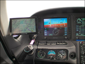
A Solid Chart Viewer
What the iFly does best is what it does right after startup: display scanned charts. The screen is crisp and readable and the charts can be zoomed in and out by on-screen buttons. It renders charts quickly enough to avoid annoyance. The aircraft position is superimposed, as we’ll as any flight plan. As these are scanned charts, they are only presented north-up. Panning the charts is a matter of sliding your finger on the touchscreen in style of an iPhone/iPad. The hardware has a good feel under the fingers and we rarely saw a screen touch misunderstood by the system.
Changing charts is equally simple. Tap the Mode on-screen button and choose from sectional or low en route charts, as we’ll as three versions of a vector (computer-generated) maps. We found these vector maps of almost no utility as they display less data than the scanned sectionals without taking advantage of the display options of vector charts, like track-up