Cell-Phone Weather: No Perfect Solution Yet

Garmin and ForeFlight take top honors for bringing weather and flight planning to the palm of your hand, but no single service hits all the high notes.

Collecting, assimilating, and safely deciding what to do about weather is one of the hardest things we pilots do. But it seems like every computer platform to do this has a drawback.

Weather terminals at FBOs are handy but require lots of clicks. I might drill down through many pages for METARs-a U.S. map, region map, and a state map-then

AvWx.net

288

scroll a long alphabetical list of stations. I go to more screens for TAFs, winds and temps, PIREPS, forecasts and satellite images. Then I try to picture the data on my route. For airport info, I pull out a book.

Flight planning software puts all the weather around one route. But it requires a computer, software and, often, arduous setup and learning. Fine for home or office, but not ideal on the road.

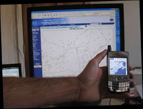
There are Web-based products to overlay METARs, TAFs, PIREPs and winds graphically on a route map. But evolution of cell phones into hand-held computers means theres an even more convenient option.

Here are the four leaders in cell phone weather. Note that your phone determines your choices or, perhaps, vice-versa.

ForeFlight

288

AvWx.Net

This might be the longest-running cell-phone weather product. It provides METARs, TAFs, winds aloft, and NEXRAD, much of it graphically, for single airports. It also offers facility data. It doesnt have advanced features like route planning or prog charts.

AvWx.nets purchase and first-use path is a breeze. AvWx accurately explains their product and provides a 10-day free trial. Options start at $7.95 per month.AvWx.net has a new, iPhone edition of its software thats optimized for the iPhone and direct access to SkyVector.com sectional and en route charts, as well as Google Maps.

The user interface is easy on the eyes and intuitive. It takes about eight seconds from launching the Website to the main menu on most phones. If you want something basic, you might stop reading here.

ForeFlight

Pilots havent had much product choice for iPhones until ForeFlight came along. Thoughtful Web pages describe a passionate team and accurate product specs. ForeFlight provides current weather, airport facilities data, easy-to-read-NOTAMs, flight plan filing and-my favorite-color-coded TAFs. Theres an online book of NOAA charts. ForeFlight uses Apples respected design conventions, so the iPhones two-finger zoom works on several map and weather images.

ForeFlight is purchased through iTunes. First use is fairly easy. Missing is my Holy

Cell Phone Weather Updates

288

Grail, however: route planning with data overlays.

ForeFlight requires iPhone Firmware 2.0. Current pricing is introductory as they develop the product, but the next upgrade is free to anyone purchasing the product today. Their website also has animated demos.

Jeppesen Mobile

Jeppesen Mobile is a big product, with weather, an airport facility data, weight and balance, route planning, flight plan filing, FARs, FSS phone numbers and, depending on your phone, pen-based input.

I couldnt find the product on the Jeppesen Website until I called Sales, who sent me to www.jeppesen.com/mobile.I downloaded the program and a small sample database. It started without a hiccup. But I was turned off by a DOS-like main page filled with 12 function buttons, the borders of which turn bright yellow when I cursored over them. The button grid is under a bright red and green menu-like bar (which isnt actually a menu) at the top of the page. Use of sacrosanct red, yellow and green aviation colors for decoration is a mistake, in my view.

More problems ensued when I clicked on a function button. It trapped me, not letting me go back or forward. I called Jepp support. They bailed me out, but admonished, “Read the manual!” The 118-page manual is a 2.75 MB download.

Cell Phone Weather Updates

288

Using the product reminded me of accessing weather at an FBO-too many clicks for too little data. Also, route planning and displays arent available. There are pluses, like a weight and balance calculator, but my 1978 Cessna T310R isnt on the list of aircraft, despite being a popular model.

I downloaded the full database on the suggestion of tech support, only to see “Download Failed.” A third call to Jepp got me up. But after eight hours, beginning to end, I gave up. For me, this product is too hard to use given what I can get from it. Jeppesen asserts that the majority of the users find the software easy and intuitive. They also reiterate that the best way to learn it is to read the manual or use the help files, which is something I only do as a last resort.

Garmin Pilot My-Cast

When Garmin announced Pilot My-Cast in 2007, it sounded like my Holy Grail. I bought a Samsung Blackjack II so I could use it. But the download and trial were problematic, as was transitioning to a paid account. A route fix failed, saying, “GVO is not a recognized airport.” Its not supposed to be; its a VOR. Tech support fixed that but erased routes I had painstakingly entered. Finally, it worked. Until the GVO problem came back.

There are other nuisances. If my cell connection is weak, it takes 45 seconds to learn its too weak for service to work. When it works well, it takes 15-25 seconds to start. It downloads data frequently during a session, each taking seconds. The user interface is off-convention in highlighting active commands and naming files to

Cell Phone Weather Updates

288

save.

I use Pilot My-Cast on just half my flights. Usually, I call FSS from my car going to the airport so planning takes no added time. Thats sufficient when the weather is good, as it often is on my milk run between Santa Barbara and San Jose, California.

Why then, might you ask (as I do), dont you just ditch Garmin? Because what I saw on first use-within minutes, without any usability help-blew me away. In some ways, its better than my dream product. Its workflow design and 3D data integration overlays METARs, PIREPS, winds aloft, animated NEXRAD, SIGMETs and AIRMETs graphically and textually on my route. It calculates route distance, wind-corrected groundspeed based on my planned altitudes and time and readies it with a single-click for DUATs upload.

Garmin never confused me. Features are self discoverable. Theres no manual. Few companies under promise and over deliver, but Garmin did for me: Nothing touts adequately their features or value.

However, Pilot My-Cast has more weaknesses. It takes longer to get station

Cell Phone Weather Updates

288

weather than does AvWx or ForeFlight. There neither prog charts nor airport facility data. TAFs arent color coded. A beta version of MyCast for iPhone is now available.

For me personally, Garmin, augmented by AvWx, wins. If I wanted an iPhone, ForeFlight would win. If I could wave a magic wand, Id add the design skills of ForeFlight to Garmin and the workflow and data integration skills of Garmin to ForeFlight.

All the vendors are pursuing the right path, though. Making weather and flight planning close by and convenient. Many pilots would be better off using any of these products over what theyre using today. Because, in the end, everyones Holy Grail is staying out of trouble.

Frank Robinson flies a Cessna T310R and coaches teams in developing new markets and products..