We all shake our heads when we read accident reports describing how general aviation pilots smack into mountains, power lines and other obstructions. Its usually the same story:
A pilot in IMC or at night, botching an approach, sinking below minimums followed by a surprise encounter with something unyielding.
Since the 1970s, pilots of airliners and bizjets have enjoyed the luxury of terrain avoidance equipment known as ground proximity warning systems or GPWS. The FAA requires most Part 121 and Part 135 operating turbines-including turboprops-to have GPWS.
By March of next year, all new turbine machines with six or more seats will have to be equipped with terrain warning systems, even for Part 91 non-revenue operations. Older aircraft have until 2005 to comply with the so-called TAWS or terrain awareness and warning system requirement.
Although long the domain of airliners, ground prox systems have now become affordable-perhaps just barely-for the light aircraft GA crowd, with the introduction of new systems from Honeywell Bendix/King and, still in the works, Goodrich.
Bendix/King TAWS
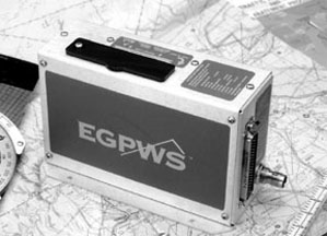
Honeywell Bendix/King is leading the way with its KGP 560 Enhanced Ground Proximity Warning system, which is just one product in an entire line of ground prox gear.
We recently installed this system in a late-model Cessna 182S owned by Connecticut pilot Robin Divinere, a stickler when it comes to safety enhancement in his airplane. The aircraft also has a BF Goodrich Skywatch system, Stormscope and back-up flight instruments. The ground prox outputs to a Bendix/King KMD550 color multifunction display.
Bendix/Kings GA-EGPWS is the first of its kind available to small airplanes, although Honeywell has been the industry leader in large-airplane terrain protection, extending back almost 25 years with high-end products such as the MkV, MkVIII and MkVI systems.
The KGP 560 meets the TAWS TSO C151a Class B category certification, which basically means it has less back-up capability than more sophisticated and expensive Class A systems which will be required in fly-for-hire aircraft.
The target market here is Bonanzas, Barons, Twin Cessnas and light turboprops. Honeywell was the first out of the gate with a small TAWS system, priced at under $10,000 for the hardware in its most basic iteration.
Its operating principle is more advanced than older GPWS, which relies primarily on radar altimetry to detect rising terrain. Instead, the baby prox is fed positional information via an external GPS source or its own integral 8-channel receiver. A built-in terrain, obstacle and runway database on a removable data-card is fed into the KGP 560 processor so it can determine where the terrain hazards are.
Terrain data is divided into grid patterns with areas ranging in size from nautical mile to about 5 miles. This gridding allows high-resolution terrain data around airports and lower resolution while enroute, when the threat is less.
Known obstacles-about 80,000 in all-such as towers, antennas, buildings and such are contained on the same datacard. Obstacles greater than 100-feet AGL are included. Since the system rounds terrain data to the nearest 100 feet, some obstacles lower than 100 feet are depicted as well.
The hardware is relatively simple, small and light. The main box is the KGP 560, a remote weighing less than 2 pounds, which includes the built-in GPS engine. Its flexible in mounting options and will run on 9 to 32 volts. No forced-air cooling is required.
Since the KGP 560 is probably going to be installed in an aircraft that has onboard GPS, using the existing GPS system for the positional feed is the best way to go, since it eliminates the need for an antenna and simplifies wiring.
You can use an existing antenna for the KGP 560s onboard GPS, but that requires a splitter, a solution we think should be avoided due to coupling issues that invite failure.
Although we didnt think so at the time of installation, the most straightforward means of feeding the unit positional information is by using GPS data output through a RS232 port. The aircrafts existing GPS-most popular GPS models should work-will feed the KGP 560 via RS232 output. (We wonder why Honeywell selected this over the faster ARINC 429 protocol. Further, RS232 is dated and it can be tricky trying to use the remote GPSs RS232 if its also being used to feed other devices, such as fuel computers.)
Although a GPS failure is unlikely, if you worry about such things, spend the extra money and set-up the KGP 560 with its own GPS and antenna.
Laptop Set-Up
System configuration is done via an external computer connected to the configuration hardware module permanently mounted in the airplane where it can be easily accessed via a laptop.
A RS232 computer cable connection is plugged in and system set-up is done via a Honeywell software program called WINVIEWS. This maintenance/set-up program is easy use and runs right from Windows, although we did run into some minor problems getting all the hardware to talk.
Although a relatively simple system, the KGP 560 doesnt work without help of external inputs. Uncorrected barometric pressure altitude information is fed to the KGP 560 via most standard altitude encoders, encoding altimeters and air data computers.
Honeywell calls this option geometric altitude, where the GPS altitude information and uncorrected pressure altitude are blended to provide exact MSL altitude to match the terrain database. With this input, the tedious chore of entering altimeter settings into the system is eliminated. Another benefit of geometric altitude is that the pilot has an independent monitor of altitude and the system will flag if it senses a difference between geometric altitude and uncorrected pressure altitude.
Our encoder of choice is the Transcal SSD120 blind encoder, which has high quality, good performance and a solid service history. Honeywell feels the same and also recommends this encoder. An optional temperature probe can be inputted to the system, which will improve altimeter accuracy when the aircraft is operated in extremely cold temperatures.
Honeywell markets a temp probe kit but a standard 500-ohm probe will work. Its a recommended option if you operate at or below 0 degrees C on a regular basis.
EGPWS in Operation
Utilizing the system to its fullest capabilities means interfacing with a remote display of some type. You can use the system in a minimal installation by simply connecting it to the audio panel and following the voice alerts-a stern Terrain, pull up! But you miss out on much of the systems potential for showing terrain hazards on a color display.
The KGP 560 provides a six-color graphical display of the terrain surrounding the aircraft when interfaced with an optional multifunction display and certain Honeywell color weather radar displays. It will also display on the popular Avidyne 740 MFD and more MFD interface potential is expected. At present, it wont display on the Garmin GNS430/530 series.
The systems 320-nautical mile range detection is obviously more than enough warning of potential terrain conflicts. The user can toggle between 2 and 320 NM range. The system automatically adjusts terrain display colors as the aircraft changes altitudes and automatically changes the display to a peaks mode, showing the highest threatening terrain ahead when enroute. It will switch to a general or relative display mode when flying closer to terrain.
This transition is done automatically without the pilot having to manually change modes. Terrain can be depicted in a 360-degree circle around the airplane or in a 120-degree arc view.
When the airplane is on the ground, magnetic north is depicted at the top of the display (north up display mode). This allows the pilot to view terrain surrounding the aircraft before departure but once the aircraft accelerates to 45 knots-computed by GPS groundspeed-the display will change to magnetic track up mode.
We found the data relatively easy to interpret when flying but we found ourselves toggling between map ranges quite a bit, especially when shooting approaches. The colors make terrain interpretation straightforward, with green indicating safe terrain (obstacles and terrain below the aircraft flight path), yellow indicating that the aircraft is not safe from potential terrain or obstacles-obstacles are at same altitude or above-and red meaning you’ll merge with the terrain or obstacle if you don’t do something. Black means there’s no significant threat.
Look Ahead
Look ahead alerting and warning, as Honeywell puts it, detects terrain or obstacles that are about one minute ahead of the aircraft. Audio alerts caution obstacle or caution terrain play through the audio system when the display shows solid yellow, for example.
If you fly yourself within 30 seconds of the terrain or obstacle terrain ahead or obstacle ahead is announced. An optional setting of terrain, pull up! can be programmed to get your attention in case youre snoozing. In this case, the accompanying terrain display shows solid red.
The trick is learning the systems characteristics. For example, 25 percent yellow dots on the screen indicate that terrain or an obstacle is 250 feet below or 1000 feet above the aircraft altitude.
Although we worried that the system would have a cry-wolf bad habit, we didnt find that to be the case. On landing with a high descent rate, it occasionally squawks but otherwise, we don’t think its burdened with nuisance alarms.
Additional Features
A feature called runway field clearance floor will alert when the aircraft descends to a point too low, considering the distance to a known runway. Using GPS position to the runway and the geometric altitude, a floor of protection is established below the aircraft.
Penetrate the floor and the display turns yellow and a voice pops up too low, too low. Fail to correct and the voice alerts at an increasing interval.Excessive sink rate is also alerted. Again, using pressure altitude inputs as we’ll as GPS vertical velocity, the system alerts via a voice prompting sink rate if the aircraft continues in a high rate of descent.
Inadvertent descent or a loss of altitude when taking off is monitored until the aircraft climbs through 700 feet. Using known runway position and elevation the system will chime don’t sink, don’t sink.
This feature on the Skylane seemed a bit too sensitive on a few takeoffs on a turbulent day. In fact, the pilots manual advises not to overreact to this warning, but do be careful when climbing near stall speed.
A feature we like is the altitude callout, alerting of 500 feet above the elevation of the runway. This function is automatically activated when the aircraft approaches within 5 miles of the runway. Its helpful when shooting an approach to minimums in actual IMC.
The KGP 560 requires a remote terrain inhibit switch. This is basically an on/off switch control and mode annunciator that turns audio graphic alerts on and off. We like to call it a nuisance switch; it gives the pilot increased flexibility, especially when the aircraft is operated around airports that arent included in the system database-basically a runway less than 2000 feet, for example, or private airports.
Also, if you regularly operate VFR at an airport surrounded by terrain, you can eliminate the terrain warnings by simply turning the switch to inhibit. The switch box of choice is the Mid-Continent MD41 series, the same design as the GPS ACU switches weve been installing for years.
Its annunciator lights are sunlight readable and the switch quality is superb. The KGP 560s system self- test can also be activated via this switch.
Conclusion
Overall, the KGP 560 works as advertised, in our estimation. Although the baby prox can run without a display-using only voice alerts-the capabilities provided by a color display make it we’ll worth the extra money. And, in any case, most owners who can afford this system will have an MFD anyway.
The KGP 560 is part of the integrated suite of avionics Honeywell calls IHAS, for integrated hazard avoidance system, which includes radar, traffic and other soon-to-be added capabilities, were sure.
Although the baby prox is a highly capable system, its also quite spendy. List price for KGP 560 is $9250, plus an adapter module required when interfacing with a remote display, which will cost an additional $2000. Add the KMD 550 display and expect another $5500 list price.
Each installation is different so its difficult to put a hard number on installation costs, especially since there are various ways to provide the KGP 560 positional information as described above. Bottom lining it here, you’ll pay a minimum of about $11,000 for this system but closer to $18,000 installed with the graphic interface, if you don’t already have the MFD.
Is that too much money to dump into a Bonanza or Skylane? In our view, thats strictly an eye-of-the-buyer value judgment. As owner Rob Divinere puts it, it only has to work once to pay for itself. Hes also looking ahead to when hell own a more sophisticated airplane with a higher class of ground prox gear. Having experience with this system will help on the training curve.
If you regularly fly in and around areas with terrain and obstacles-and most of us do- the KGP 560 will do the job its designed for. And if you need to fulfill the requirements of the Class B TAWS rule, the KGP 560 is the cheapest way to get there.
Contact- Honeywell Bendix/King, One Technology Center, 23500 W. 105th Street, M/D #45, Olathe, KS 66061-1950, 877-712-2386, www.bendixking.com.
Also With This Article
Click here to view “TAWS in a Nutshell.”
Click here to view the Checklist.
Click here to view “Ground Prox Test Flight.”
-by Larry Anglisano
Larry Anglisano is an Aviation Consumer avionics editor and a consultant for Exxel Avionics in Hartford, Connecticut.