by Paul Bertorelli
When the FAA first rolled out GPS approaches in 1994-yes, it has been nearly a decade-we thought that to be a good thing. Last July, the agency officially turned on the Wide Area Augmentation System that makes GPS more accurate and more reliable and opens up the vast majority of backwoods airports to IFR navigation, including precision approaches. So thats got to be better yet, right?
Definitely. But that doesnt mean every owner should rush right out and buy a WAAS box. While its true that WAAS can be called revolutionary technology, its also true that its impact on flying IFR is likely to be evolutionary for quite some time to come. The reality is that for now, a skinflint owner in a Cherokee equipped with a couple of KX-170s and a Garmin 195 can do 80 or 90 percent of the IFR operations that the well-heeled owner of a cabin class twin equipped with dual color mapcomms can.
The owner of a cutting-edge panel can fly into a few more outlying airports than the Cherokee driver can and he enjoys a measure of additional safety thanks to the superior accuracy of GPS. But the Cherokee owner will rarely be prevented from going somewhere IFR for his lack of WAAS-capable GPS and that truth may endure for several more years.
The word rarely does imply a degree of doubt, however, so its worth asking and answering these questions: if you buy WAAS now, what do you get out of the deal? How about in two, three or five years? Asked another way, is there any harm in waiting it out for awhile? Answer: it depends, but probably not.
In the Beginning
As with every other high-dollar government program, GPS-and especially WAAS-was over promised. Ironically, the promised capabilities are actually materializing and, in some cases, being exceeded. Its just that it has taken longer to get here than the FAA said it would. (Big surprise.)
GPS was long ago supposed to have supplanted terrestrial-based navigation but we are only now getting to the point where we can see that day. This system has taken its sweet time to develop and the FAAs start/stop glacial pace has driven some manufacturers (and aircraft owners) to the brink of insanity.
As an IFR navigation aid in lieu of VOR, raw, unaugmented GPS is an order of magnitude more accurate when an airplane is more than a couple of miles from the ground station. Its less impressive when measured against Cat I ILS and not in the same accuracy/reliability league as Cat II ILS.
That, and the fact that raw GPS has significant signal integrity shortcomings, stunted GPSs future and begat WAAS. The golden promise was that WAAS would plug the leaks in the GPS dike and although delivered over budget and behind schedule-its still a government program, after all- WAAS looks like its going to deliver on that promise and more.
As fielded now, WAAS consists of 25 ground monitoring stations which continuously sample signals from GPS satellites passing overhead. They relay data to two wide area master stations which then uplink GPS differential position corrections, health and integrity messages to a pair of geosynchronous satellites positioned for coverage of the continental U.S.
These signals then drift back down from space to ground, seaborne or airborne receivers. They look to those receivers just like another GPS signal, albeit one with important data to improve GPS accuracy from about 100 meters 95 percent of the time to better than 7 meters. Actual WAAS performance has proven better than that. Throughout its brief history, GPS technology has shown a remarkable ability for evolving in unpredictable but desirable ways and early performance metrics suggest WAAS is doing the same.
WAAS: Why It Matters
So does it matter that with WAAS, you can nail the centerline of an airway to an accuracy of under 30 feet rather than 300 feet in the bad old pre-WAAS days? Not really. Raw, unaugmented GPS is so much more accurate than VOR or (gasp) NDB that its a far better and more reliable area navigation tool than any previous navigation system. WAASs enhanced accuracy begins to matter when you descend closer to the surface of Mother Earth and the closer you get, the more it matters.
When the FAAs first GPS approaches arrived in 1995-they were overlays of existing non-precision VOR and NDB procedures-anyone accustomed to flying wing-and-a-prayer NDB approaches into outlying airports would have noticed something odd. Using the overlay, you could nail the runway centerline every time rather than fishing for it at a different spot depending on the wind and the mood of your alternator. The minimums on overlays werent any lower than the underlying approach but the fact that you could maintain the runway centerline more accurately made them both more effective and safer, especially on VOR approaches distant from the station or on NDBs.
The advent of WAAS only improves that and it adds the vertical dimension right now, not six months or six years in the future. Many of the existing LNAV/VNAV GPS approaches that have vertical guidance are aimed at runways that already have either an ILS or an existing GPS approach. No major gain there. But as these approaches multiply, they will inevitably serve runways at outlying bergs.
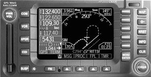
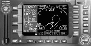
In any case, LNAV/VNAV is all dressed up with no place to go. In one of those rare instances when the FAA got momentarily ahead of the industry, WAAS approach capability exists before there are even boxes capable of flying them. (The UPSAT-now Garmin AT-CNX80 pioneers this capability but it wont be certified for WAAS approaches until the end of 2003.)
Heres a brief explanation of WAAS approaches, which are the future of GPS navigation: Going forward, and ignoring existing conventional approaches for the moment, the approach of the future will be a single procedure with three sets of minima: LNAV, LNAV/VNAV and LPV. All of these will be titled as RNAV (GPS) on your approach plates.
Think of an LNAV as being identical to a current non-precision GPS approach or even as a VOR approach but with better accuracy. With WAAS available, an LNAV/VNAV adds vertical guidance-think of it as a glideslope-to descent minimums a little lower than a non-precision approach but higher than a precision approach.
While most LNAV/VNAVs have lower descent minimums-like an ILS, they have a decision altitude-they tend to have higher required visibility because non-precision LNAVs do.
Last is the LPV or the GPS near-equivalent of a Cat I ILS, with vertical guidance down to 250 feet above touchdown. (Thats why its near-equivalent; a traditional Cat I ILS offers a 200-foot HAT and a minimum of 1/2 mile required visibility, best case.) LPV, by the way, is a set of letters with no meaning. GPS approaches have accreted all sorts of acronyms and LPV is yet another.
So where are we now with all of this? As of press time, the FAAs flight procedures division tells us that there are 613 LNAV/VNAV approaches published and seven LPV approaches at airports including Gaithersburg, Maryland, Oklahoma Citys Will Rogers Airport, Frederick, Maryland, Oshkosh, Wisconsin and Salem, Oregon.
Obviously, given the sites, these are pump-starter procedures but theyre flight checked, approved and ready to go as soon as navigators capable of flying them appear. The FAA plans to develop another 300 LPV/LNAV/VNAVs for 2004 but flight check limitations will slow the pace of LPV approvals.
The existing LNAV/VNAV procedures are spread around the country but, in keeping with its plan to duplicate the current airspace system before venturing into uncharted territory, all of these approaches are at airports that already have IFR access, some even with ILSs.
If thats the case, then whats all this WAAS palaver buying us? Not much, at the moment. At many airports that are just getting WAAS-type approaches, an ILS is a better deal when the weather is down, if there is an ILS.
But the WAAS heads think thats the wrong way to look at this new system and we have to agree. As the approaches (and the navigators to fly them) are fielded, WAAS will do two things: it will steadily nibble descent minimums significantly below the best now available and it will introduce precision approaches with vertical guidance to airports that now cant afford them.
And assuming the potential confusion of setting up WAAS navigators to fly approaches doesnt lead to any smoking craters, having positive vertical guidance is undeniably better and safer than using an altimeter solely to stop the crash dive down to a published MDA.
A survey done by the Mitre Corp.-which provides technical consulting services to the FAA-revealed that about 60 percent of the IFR-capable runways in the U.S. might eventually qualify for an LPV approach. That doesnt mean all will get one, but the potential is there.
There are other benefits-subtle now but less so five years from now. Going forward, WAAS-equipped aircraft will be able to file airports served only by GPS approaches as alternates, assuming the airports meet other requirements for alternate status. Another key point: Eventually, there will be far fewer approaches to contend with then there now are. According to the FAA, your U.S. plate coverage bulges with 14,000 procedures, counting both GPS and conventional approaches. The FAA is groaning under the strain of trying to flight check and maintain so many approaches. (About 8500 are conventional approaches, the rest are GPS.)
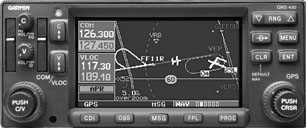
These numbers raise a difficult chicken-and-egg paradox. To control its budget and streamline the program, the FAA would like to forthrightly pare back conventional approaches. But until more of the fleet is WAAS or even GPS equipped-in other words, until owners buy more of this stuff-it cant do that. That leads directly to another WAAS dilemma. Will this system permit GPS as a sole means navigation system or not? For the moment, its a moot point, at least for owners contemplating buying into WAAS. The Garmin AT CNX80 will be the first WAAS-capable navigator but its a hybrid box, with both VOR and LOC/GS built in. Next up, the Garmin 430/530 navigators, also have VOR and ILS capability so GPS as sole means isn’t yet on the table for the equipment being sold now.
Garmin says WAAS upgrades for those boxes will cost no more than $1500, a terrific value given what the upgrade involves.
What to Do?
Does it make sense to rush right out and buy a WAAS receiver? We think it depends on what kind of flying you do and whether you go there IFR. Lets say youre based at an airport with an ILS and you fly mainly into well-equipped metros or you don’t fly much real IMC. WAAS wont do much for your program at the moment. True, its more accurate and has better integrity but its not like GPS is leaving anyone in the lurch, accuracy wise.
On the other hand, if youre based at a country airport that now has an NDB, perhaps with an overlay, you’ll soon start to see LNAV/VNAV procedures into those fields. Some will have lower minimums, some wont. But even if they have the same mins, the LNAV/VNAVs have positive vertical guidance and thats better and safer than not having it.
As the FAAs WAAS approach program advances, you’ll see approaches with lower minimums-50 feet here, 100 feet there; modest improvements that will inch the entire airspace system toward incrementally better capability.Then, perhaps when you least expect it, an LPV with 250 feet and a mile will appear at an airport near you.
Also With This Article
Click here to view “Checklist.”
Click here to view “What You Get Out Of the Deal.”

