For any owner who has one-and thats most of us these days-GPS has all but relegated the traditional navcomm to the scrap heap. Not bad for a system thats technically not legal for IFR navigation unless accompanied by technology that was cutting edge when Harry Truman was in the White House.
Then again, isn’t that the rub? While aircraft owners have thus far shelled out the bucks for state-of-the-art GPS that still includes integrated VOR/ILS, arent some of us becoming impatient with the glacial pace of the GPS revolution? Yes and no.
On the one hand, it seems a shame to maintain an aging, multi-million dollar VOR system while GPS catches up. On the other hand, the FAA has made substantial progress in building GPS approaches into dozens of in-the-sticks airports, even if most of us don’t seem to want to go there when the weather tanks. In other words, the FAA built it, but we arent coming. Whether that evolving infrastructure will pay off eventually remains to be seen.
In the meantime, owners have to contend with how to play equipment decisions against the other big technological player here, the FAAs oft-delayed Wide Area Augmentation System. Everyone seems to assume this system will come along eventually and those in the industry weve interviewed finally seem confident that WAAS will arrive in late 2003, perhaps a earlier. That said, there are lingering doubts that GPS will ever render VOR obsolete; indeed, even loran, which the Coast Guard has all but left for dead, is still under consideration as a back-up system for GPS.
Wheres WAAS?
When originally conceived, WAAS was supposed to be a done deal by 1999, making GPS a fully-certified sole means IFR system. By 2001, the system was intended to be fully redundant and capable of handling everything down to a Category I ILS, with the more demanding Cat II and Cat III ILS tasks handled by local area augmentation or LAAS.
Because of budgetary and technical constraints, it hasnt quite worked out that way. It didnt help that in 1996, with the $475 million contract lagging, the FAA fired the prime contractor, Wilcox Electric, and started over again. Within months, it let another contract to Hughes Information Technology Systems, which, with other subcontractors, picked up where Wilcox left off.
The program lurched forward, stumbling over-and eventually solving-various technical issues related to signal quality and reliability to the point that there appear to be no show-stopping technical hurdles to WAAS providing the basic service promised: a differential signal for improved accuracy and an integrity signal at least comparable to the type of signal monitoring thats been standard for VOR and ILS for years.
Even though behind schedule, the WAAS signal was finally turned on last year, but only as a test signal from two of what the FAA hopes will eventually be three WAAS geostationary satellites. GPS manufacturers have been using this test signal as a basis to develop the next generation of GPS receivers.
R&D
Speaking of which, whats the latest on the next round of avionics, the super WAAS boxes that will render everything in the current panel utterly obsolete? Our impression is that these navigators are we’ll along in development, but at least a couple of years from being market ready, at least in a competitive sense.
Thanks to dithering in Washington, the avionics industry again finds itself at a difficult crossroad. The WAAS TSO-C146-is essentially done but lacks some important detail necessary to lock down the final receiver design. Manufacturers who don’t envision an upgrade path for their current products-and for the little airplane crowd, thats chiefly Bendix/King and UPSAT-have little incentive for an early push toward WAAS or even to mention it since at some point buyers will cool on the current products, awaiting the new WAAS equipment.
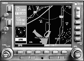
Garmin appears to be farthest along in its WAAS development, having cast an eye forward toward WAAS when the GNS430/530 navigators were designed. Yet until the WAAS TSO (C146) is set in stone, Garmin isn’t able to say with certainty how the upgrade will work. But Garmins Tim Casey says it wont cost owners any more than $1500 to upgrade a 430/530, if it costs anything at all.
Will that be a software upgrade or a hardware upgrade? Or both? Garmin says it doesnt know yet and wont until the FAA settles on some final specs on the WAAS signal. Still, we don’t get the impression that Garmin is chaffing at the bit to have WAAS-capable navigators ready to sell.
There seems to be even less urgency at Bendix/King and UPSAT/Apollo, where WAAS navigators are being developed but at a slower pace and with no promises on upgradeability of the stuff being sold today.
Bendix/Kings Dan Barks told us that the company will offer some means of upgrading to WAAS, either via an attractive trade-in or an upgrade of its most recent GPS navigator, the IFR-capable color KLN94 map. But Bendix/King hasnt decided which it will be, Barks said.
If the KLN94 is to be WAAS capable, it will require a hardware upgrade, not just new software. Our guess on this one is that you’ll see an entirely new product from Bendix/King, probably one that takes advantage of the kind of sensor integration Bendix/King has pioneered with its IHAS product. (See Aviation Consumer, November, 2001.)
UPSAT/Apollo has taken a different tack than Garmin, building a series of IFR navigators with minimal maps but with the well-received MX-20 color multi-function display as an accompanying option. Were sure that the MX-20 will remain in UPSATs line but the companys Sam Seery tells us that the GX-series IFR navigators wont be upgradeable to WAAS but that a new product line will eventually be introduced, with WAAS built in.
We have no details on that yet but our prediction is that it may be something designed to integrate with the MX-20, which has become too much of a mainstay in UPSATs line to give away sales to a color map stablemate.
Our idea of nirvana for this product line would be a touch-screen enabled MX-20 driving a remote mounted GPS navcomm, thus freeing up panel space for another display or some sort or a back-up navcomm.
A Good Deal?
That the markets ardor for WAAS has cooled is understandable, given the delays and some uncertainty about what it will do for the customer who invests in it.
As currently construed, the real action for WAAS is limited largely to approaches and even then, what benefit it brings will hardly be dramatic, in our estimation. As explained in the sidebar, at their very best, WAAS approaches will be like CAT 1 ILSs, with DH/DAs between 200 and 300 feet and required visibilities in the -mile to 1-mile range. We suspect most of these will tend toward the higher minimums.
None of those have been designed yet for public use but the general thinking in the industry is that there are no technical barriers to making them happen.
But there are physical barriers, namely the unfriendly obstacle environment around the many outlying airports that a WAAS approach could conceivably open up to low-IMC operations. With trees, hills, buildings and cell towers encroaching, many small airports cant support an ILS and wont be able to support more affordable WAAS precision approaches either, since the obstacle clearance requirements are the same.
Moreover, even if the local terrain allows it, a precision approach requires a local survey, runway markings and lighting, which some airports simply cant afford.
That means as GPS moves forward, if they have any approaches at all, the future has already arrived for many small airports in the form of non-precision procedures with MDAs in the 300 to 1000-foot range. Better than nothing, of course, but hardly the CAT 1 ILS for every burg some may have envisioned.
As far as we can tell, GPS for sole means navigation-that is, sans VOR-is off the table. The FAA and others in the industry arent yet satisfied that even GPS augmented by WAAS will be reliable enough to serve as sole means navigation without back-up from some other system. Last spring, the FAA chartered an independent review board to assess GPSs technical status, including its potential failings.
The board concluded that the FAA was on the right track with GPS but the fact that the WAAS system depended on only two geostationary satellites-one to serve the west coast and one to serve the east, with overlapping coverage in the center of the country-made it too vulnerable to a single-point failure of either satellite. The IRB recommended a third satellite and the FAA recently received funding for that project. Further, there are continuing concerns about RFI jamming of GPS, something that would render an aircraft navigationally blind without some kind of back-up. (In the post 9/11 era, this is no longer an idle worry.)
The question is: what back-up? For the time being, VOR-DME serves we’ll and is, in fact, the only approved primary IFR navigation system; GPS is still officially supplemental. Curiously, loran is getting a second look and the FAA is pumping research money into the system to determine if its suitable as a WAAS backstop, transmitting the differential and integrity data to airborne receivers and also providing a usable if somewhat less accurate basic navigation signal.
Early testing suggests that loran can do the job but the other side of this coin is aircraft equipage. Were not talking about dusting off your old Apollo 614 here but modernized systems complete with state-of-the-art H-field antennas to minimize P-static and thunderstorm interference. Presumably, a loran unit would be part of a multi-sensor system, not a discrete panel-mounted box. At this juncture, the loran back-up investigation looks to be a long-term project which suggests to us that the FAA wont solve the sole means issue soon, even if it wants to.
LAAS, Too
Fielding new technology is rarely a slam dunk nor has it been for GPS. Five years ago, WAAS was the white knight that would do away with conventional ILS and VOR ground stations, saving the FAA a pile of money along the way. The reality, however, is that WAAS performance is stretched to the limit to deliver Cat I ILS accuracy and depending on it to deliver the more stringent Cat II/III ILS accuracy was deemed impractical if not impossible.
But local area augmentation (LAAS), with its faster data rate, more robust signal and increased accuracy has been shown to be capable of CAT II/III performance. LAAS is therefore now a hot item in the FAA and has gained favor in the influential airline community, which is interested only in precision approaches with vertical guidance and could care less about procedures into the outlying munis.
Thus far, none of the manufacturers of small aircraft GPS have LAAS boxes on the front burner, simply because conventional ILS will be available for quite some time at the major terminals where little airplanes go only occasionally.
Further, LAAS requires datalink receivers to collect the local differential signals and these are just now coming into market view. With its VDL Mode 2-based KDR510 data radio, Bendix/King may have a leg up in this field. The KDR510 is designed for Bendix/Kings groundbased weather datalink products but it can clearly be used for LAAS signals, too.
UPSAT has its own version of this technology called UAT or universal access transceiver. It too is designed for other purposes-namely ADS-B air traffic and anti-collision products and weather broadcasts. Presumably, it could also be pressed into service for LAAS, should the demand materialize. (We doubt that it will for small airplane GA.)
For its datalink offerings, Garmin has pursued the Orbcomm system of low-earth orbit satellites for weather datalink. This system isn’t suitable for LAAS because of its slow data rate, thus Garmin has put its eggs into other baskets.
Future Boxes
For small aircraft GA, then, what buyers should expect to see as WAAS comes closer to reality are entirely new products from Bendix/King and UPSAT, not hardware upgrade paths for existing equipment. To hold marketshare, these companies will probably offer attractive trade-ins on the equipment theyre selling now.
From Garmin, expect a direct upgrade path for the GNS 430/530 boxes, either as new software or both hardware and software, in the form of a factory supplied board. If we were betting, we would guess that these products will get by with just the software upgrade.
From the pilot operational point of view, this wont change much. Garmin envisions its WAAS navigators as being menu driven, just as the current technology is. As WAAS approaches become available, theyll simply be added to database and will appear as additional menu items.
Select the approach, engage it and fly it just as you would any other precision or non-precision approach. Since the navigator itself will do the math to figure out the vertical glidepaths, the databases themselves wont be much larger than the current versions.
Whether the advent of WAAS navigators will significantly change the GA landscape is an unknown but our prediction is that they wont have meaningful impact for the foreseeable future for several reasons. The leading one is that if owners don’t see impressive benefits at the outset-and we predict they wont-only the early adopters will replace recently purchased IFR GPS with new WAAS GPS. If Garmin engineers an easy low-cost upgrade to WAAS, there’s no reason owners shouldnt spring for it, however.
Second, the number of approaches to small airports may continue to mushroom but because of the aforementioned limitations on approach design dictated by local obstacles, the ability to get into a small airport in low weather wont always improve much. Last, GPS as sole means still looks iffy without some kind of back-up, which may turn out to be VOR or even loran.
On the plus side, with their laser-like accuracy, GPS approaches have proven to be a life changer for that small number of pilots who fly serious IFR out of outlying airports that once had only an NDB or a high-mins VOR approach. A GPS approach is undeniably safer because it keeps the airplane on the centerline, giving the pilot a better shot at seeing the runway on a claggy day where he might have missed the approach five years ago. In our view, this is a real plus.
For the near to mid-term, however, an IFR GPS navigator bought today-even a crusty old used Garmin 155 or a Northstar M3 nipped off the used market-will soldier along for years, opening up the vast majority of outlying airports with GPS non-precision approaches. And if you don’t fly more than one or two of those a year anyway, why do you need a high-dollar WAAS navigator?
On the other hand, WAAS probably will open up a small number of airports with approaches that have both slightly lower minimums and vertical guidance. If you go to such places-or plan to-a new WAAS receiver may be worth the wait.
Also With This Article
Click here to view “Checklist.”
Click here to view “Future GPS Approaches: Plentiful, Yes. Simple, No.”
Click here to view “WAASs Uncertain Timetable.”
Click here to view “Impressive Accuracy.”