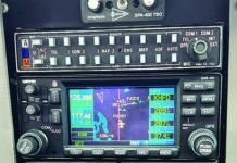
The iFly GPS app from Adventure Pilot was born from the iFly 700-series GPS navigator, an intuitive tablet-based EFB that is being redesigned to include a better display and internal power supply.
What got our attention is the iFly apps flexibility to run on both the iPad and Android devices, a rare and welcomed option in the world of aviation apps.
After flying with iFly GPS on both platforms, we like its simple flight planning and data entry process, shallow menu structure and useful graphics.

Cut-to-the-chase Nav
At the core of the iFly app is its straightforward mapping capability and intuitive feature set. But even better is that the app has a simple navigation logic. Adventure Pilot boasts that the program doesnt need a pilots guide and we agree, although we think there should be one in the apps menu structure.
With any navigation app, the key to simple operation is a feature set that has minimum menus, and that is just how iFly GPS is designed.
Menu tabs are located at the bottom of the screen, starting with a Menu tab that is pleasantly shallow. Also appreciated is a Fly Direct To option, which brings up a editable data box with a sufficiently sized onscreen keyboard for typing either full text or identifiers for where you want to go. iFly provides the option of finding only airports, VORs, intersections, fixes, custom waypoints or any combination thereof, simply by selecting search boxes. The app also keeps track of previous searches and waypoints, saving data entry time.
A dedicated Map tab is for selecting a map mode, and includes sectional charts (iFly uses Vector maps, which have scalable graphics for higher resolution), low altitude enroute charts, terminal area charts and NOAA approach plates, plus surface diagrams.
Its worth mentioning that while the app has detailed waypoint and airport information, including fuel prices, it is a full-time map display. The app has a built-in day and night mode function that adjusts the screen brightness. We ran the app on an iPad mini3 and Samsung Galaxy Tab S 8.4, and both offered good graphics display.
While on the topic of screen quality, we think the onscreen presentation is acceptable and mapping is crisp, but suspect users accustomed to other top apps will ding it for its lower resolution menu nomenclature. If you are familiar with the iFly GPS dedicated hardware, you’ll feel at home with the app.
Adventure Pilots Shane Woodson made it clear that unlike other apps, iFly charts are not scanned. Instead, they are direct from the FAA in digital format and then put through a proprietary process that enhances, improves the contrast, and optimizes them to run faster and take up less space on the devices. He noted that the iFly GPS app takes a smaller amount of space than competitive apps, even with the high-definition charts and terrain data loaded. That is a major concern for us and others running many apps.
The Map Mode menu has a selection for overlaying weather data-either Internet weather for preflight planning-or from a variety of ADS-B weather receivers, including the iLevil, SkyRadar and Dual XGPS ADS-B devices.
All map modes include a vertical profile terrain window, which can be expanded into a larger window. You can zoom in and out and control its alert functions. The app has attention-getting terrain audio alerting that is plenty loud enough to hear while wearing a headset.
Map mode also has an option for displaying configurable flight instruments. This can be a full page display, or overlay of individual instruments at the top of the map page, including an HSI for GPS course guidance. Missing is a tape-style flight instrument display, as is synthetic terrain data, but a round-gauge attitude display can depict AHRS-derived pitch and roll data when connected to a compatible ADS-B receiver. Adventure Pilot said it could add synthetic vision in the future, but doesnt think there is sizable user demand.
Flight planning is a snap; simply select the Flight Plan tab, set the departure and destination airport, plus the waypoints along the way, and iFly figures out the rest, including fuel burn that is based on the stored aircraft profile. A More Options tab allows you to reverse the route, set a cruising altitude and check airspace along the way. An online flight plan filing option interacts with Lockheed Martin Flight Services.
RealView Imaging
A function that is exclusive to iFly, RealWorld airport imaging includes satellite images of over 12,600 public and private airports. iFly takes the function one step further and provides georeferenced positioning and interfaces it with its AutoTaxi+ function. These RealView images are hard-loaded into the app database.
One way to access the RealView graphic is to simply tap on the airport from a map, and then tap the OPTS tab. Within the Possible Actions menu, you can select the RealView Airport tab. The Possible Actions menu also enables a Fly Direct To here command, for going to the airport. Once navigating directly to it, a course line is drawn from your current position and extends to the center of the airport within the RealView satellite image.
A dedicated NRST tab, for nearest airport search, has a submenu for navigating directly to it, adding it to a flight plan, showing it on the map and viewing approach plates and airport diagrams. Once you select the airport, iFly tells you everything you would want to know about it, including runways, frequencies, fuel prices and hours attended, to name a few.
Choose your Device
Adventure Pilot says that its app has been beta tested by a team of 400 pilots. We followed an online iFly beta test forum and its clear that Adventure Pilot makes good use of real-world feedback.
Unlike some other apps that are adding cost options to existing subscriptions, there are few upgrade options with iFly. All of the apps functionality is included for iOS, Android and in the dedicated iFly 720 and soon to be released iFly 740 tablet GPS. VFR subscriptions are $69.99, IFR subscriptions are $109.99, and if you happen to own an Android, iPad and the iFly hardware, you can include all three devices on a single subscription for $19.99 extra.
A free iFly GPS trial can be downloaded from the Google Play store (for Android), the Apple App Store (for iOS) and more information is available at www.iflygps.com. Contact them at 888-200-5129.


